
The water level sensor is today associated with industry, pumping stations, tanks and networks. Yet, the idea of measuring a water level dates back to antiquity, driven by the objective of mastering a resource that conditions the survival and organization of societies. As soon as communities settled near rivers, water height took on strategic value. Regular observation, then the establishment of comparable benchmarks, constituted the first steps of a structured and reproducible measurement.
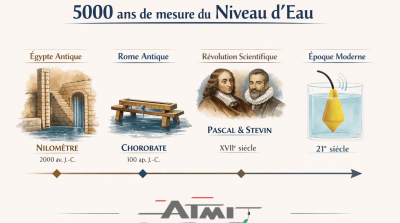
In ancient Egypt, variations of the Nile determined the economic balance with the success of harvests and the safety of villages. The Egyptians then developed devices dedicated to reading the water level, grouped under the term Nilometer. The principle rested on a fixed reference associated with graduated marks, allowing interpretation of water level variations throughout the seasons. Depending on locations, the form could vary: a well connected to the river, a staircase descending to the water with marks, or a graduated column.
The Elephantine site in Aswan testifies to this search for precision with its staircase device housed in a well whose walls bore graduations. The refurbishments carried out in Roman times confirm the importance of maintaining a stable public reference for monitoring the river. Inscriptions mentioning exceptional floods transformed hydrological data into historical archives associated with the ruling power.
The use of Nilometers was a matter of technique as much as political management of the territory. In the Islamic era, the construction of the Nilometer on Rawda Island in 861 by Caliph al-Mutawakkil reinforced this administrative dimension. Recording floods made it possible to evaluate tax levies according to expected agricultural productivity. The water level acted as an essential state indicator for authorities and the population. Museum institutions emphasize that these structures served as a standard for calculating land taxes proportional to the magnitude of the annual flood. The durability of the Rawda structure and the publicity of its readings combined technical rigor with administrative necessities. Recent archaeological research confirms that these measurements helped anticipate harvests to establish budgetary estimates. Water level represented fundamental quantified data for the country's economic and social balance.
The use of level benchmarks diversified during the Hellenistic period to meet the technical needs of ports and distribution networks. This evolution allowed builders to stabilize water heights in cisterns and optimize the flow of navigation channels. The contribution of Greek technicians established in Egypt favored the transition between traditional river monitoring and precision surveying.
Fluid observation was then split into two complementary technical functions. The first concerned depth monitoring in a given environment while the second exploited the principle of horizontality for site surveying. The objectification of the hydraulic level thus made it possible to lay the theoretical foundations of modern water level detection.
The construction of Roman aqueducts required perfect mastery of slope over considerable distances. Builders used the chorobate as the main leveling instrument to ensure alignment of structures. This device consisted of a long rule equipped with control devices intended to verify the horizontality of work.
In case of strong winds, workers used plumb lines with an upper groove that received a quantity of water to materialize a perfectly stable reference plane. The liquid then served as a reliable guide to ensure slope precision and network viability. This method demonstrates the historical convergence between hydraulic measurement and the geometric requirements of civil construction.
After the Roman era, the use of water as a level reference did not disappear, even if medieval testimonies more spontaneously evoke the plumb line, the square and mason's levels than the formalized hydraulic device. The great stone construction sites of medieval centuries relied on a culture of geometric control, based on bed horizontality and wall face verticality, with simple tools whose effectiveness lay in their repeatability and trained eye. In this continuity, the free surface of water that naturally stabilizes horizontally remains an intellectual and practical benchmark, present in the background of construction site knowledge, ready to be mobilized as soon as a level must be transferred without depending on a line of sight.
The shift occurs more clearly in the modern era, when surveying and leveling enter a phase of methodical refinement, driven both by state needs and by the formalization of physical sciences. The principle of communicating vessels, understood as equality of free surfaces in connected containers, then becomes a mental instrument as much as a field tool, because it authorizes the transfer of an altitude between two distant points even when the gaze encounters a wall, partition or terrain accident. This rise in rigor is accompanied by a language formulation of phenomena, which makes practice transmissible, discussed, criticized, improved, and it is in this atmosphere that the water level finds its full legitimacy as a measurement method.
The theoretical foundation clarifies at the turn of the 16th and 17th centuries with Simon Stevin (1548-1620), whose work contributes to giving hydrostatics a demonstrative architecture and linking level equilibrium to pressure laws in liquids. This scientific ordering does not create a practice ex nihilo, it gives it a framework, a way to justify and correct itself. In the following century, Blaise Pascal (1623-1662) reinforces understanding of fluid pressure and consolidates the conceptual background on which any hydrostatic leveling method rests, recalling that the stability of a liquid at rest obeys rules that lend themselves to measurement.
In the same movement, territorial measurement becomes a scholarly and administrative enterprise, and leveling fits into a more explicit technical literature. Jean Picard (1620-1682), major figure of French geodesy, embodies this systematization ambition that goes beyond individual construction sites and aims for measurement coherence on a large scale. In this historical framework, the water level establishes itself as an ingenious transposition of a hydrostatic equilibrium law into a field instrument, since a flexible conduit or transparent ends suffice to make a common horizontal plane visible, provided the parameters governing any reliable reading are mastered. Sensitivity to thermal variations and the presence of air bubbles are not a detail, they belong to the very requirement of measurement, the one that obliges holding the assembly, gesture and interpretation with rigor. What is at stake here belongs to a long history where the most elementary physics becomes a precision method as soon as it fits into a disciplined art of practice, transmitted and continuously corrected by experience.
The industrial era places water level measurement at the heart of a new technical landscape, that of boilers, steam engines and urban networks. Energy drawn from steam imposes permanent monitoring of water contained in generators, because a drop in water level endangers the very integrity of the boiler. The 19th century accidents, very well documented, recall the violence of explosions and how design and maintenance improvements gradually pushed back these catastrophes at the end of the century. Direct level reading devices, including the transparent control tube known as "sight glass", then take on a safety value as much as operation.
This period also sees the rise of a measurement culture that goes beyond simple observation, because industry demands instruments capable of translating physical phenomena into signals interpretable by the operator. The Bourdon tube pressure gauge, patented in 1849 by Eugene Bourdon (1808-1884), marks a decisive step in this history, since it makes pressure more easily measurable in production environments. This advance indirectly nourishes the evolution of water level measurement, because pressure and differential pressure become preferred routes for estimating liquid height in closed tanks, then for standardizing control practices in large-scale installations. In the same spirit of safety improvement, Stephen Wilcox obtained a patent in 1856 on a water tube boiler, before joining George Herman Babcock (1832-1912) and founding Babcock and Wilcox in 1867, a major milestone in the diffusion of safer and more efficient generators, which require reliable and readable instrumentation.
In the 20th century, industrialization changes scale and water level measurement fits into automation. Instruments gradually leave simple local reading to become elements of a regulation system, capable of feeding a command, recording, then supervision. Progress in pneumatic controllers and industrial recorders, carried by actors like Foxboro in the early century and in the 1930s, accompanies this transformation, because an industry organized around continuous process needs stable measurement to maintain quality, safety and productivity. Later, the emergence of radar technologies applied to water level, whose first industrial milestones are situated in the early 1970s, opens the way to contactless measurements adapted to difficult environments.
The social contribution goes far beyond the workshop, because the reliability of water level measurement contributes to worker safety, continuity of urban services, expansion of water and wastewater networks, as well as reduction of industrial accidents that marked the beginnings of steam.
In the 21st century, water level measurement fits into engineering where data circulates as much as fluid. Water network industrialization, expansion of automated stations, remote supervision and generalization of control architectures have shifted the challenge toward service continuity, traceability and maintenance. The variety of available technologies illustrates this maturity, with contactless radar solutions, ultrasonic measurements, hydrostatic approaches based on pressure, and sensors integrated into standardized signal chains. This technical diversity responds to very contrasting operational realities and contemporary requirements of process reliability and safety.
In this current landscape, sophistication has not erased another logic, older and more pragmatic, that of robustness and controlled simplicity. Many operators continue to favor proven and easy-to-diagnose devices, particularly when environments are loaded, agitated, or when installation environment makes electronics more vulnerable. Water level measurement then belongs to a balance between expected precision, real conditions, maintenance constraints and regulatory imperatives. Technological choices are rarely made by fashion, and much more often by usage coherence, in an industrial culture that values repeatability and durability over time.
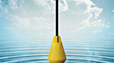
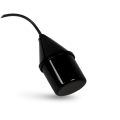
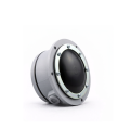
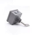
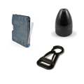
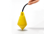
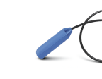
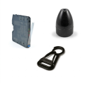
It is in this continuity, between modern requirements and field expertise, that ATMI fits. The company presents itself as a specialist in float level measurement for liquids and solids, with an approach centered on float switches and float level switch level regulators, omnidirectional and tilt, intended to open or close a control circuit according to water level. ATMI has a wide range of level sensors, with a plurality of switches offered in many versions, as well as positioning as a French manufacturer established in Ile-de-France. In a world where instrumentation can become complex, this orientation maintains a guiding idea, that of a water level sensor designed to remain usable and durable as close as possible to operational constraints.
Discover our range of level sensors!
ATMI, level under control.